
 |
|
|
|
|
|
Sequence Boundaries
in Devonian Black Shales, |
|
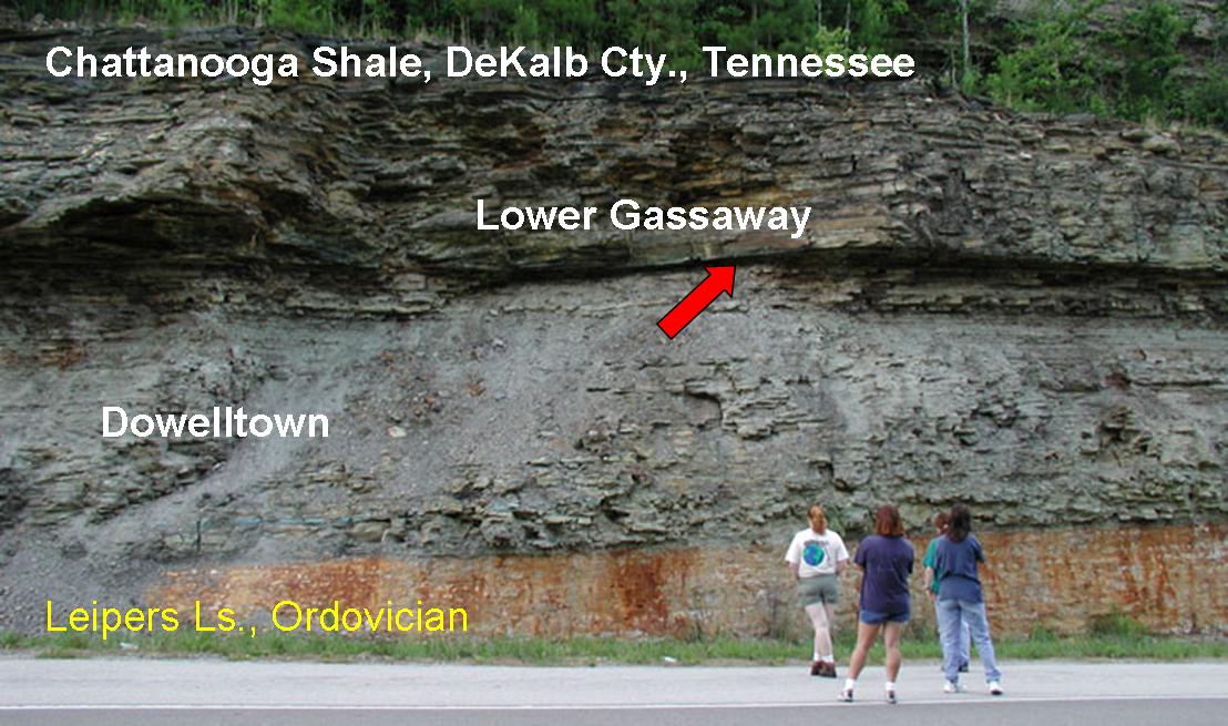 |
The red arrow points to the boundary between the Dowelltown and Gassaway members of the Chattanooga Shale. This surface coincides with the Frasnian/Famennian boundary, but the uppermost Frasnian has been removed by erosion. |
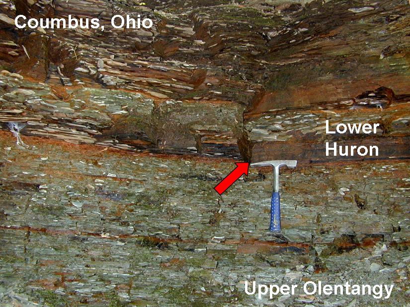 |
The red arrow points out the erosive boundary between the Olentangy Shale (Frasnian) and the Ohio Shale (Famennian, above hammer). The lowermost portion of the Famennian is missing here. It was either eroded or never deposited. |
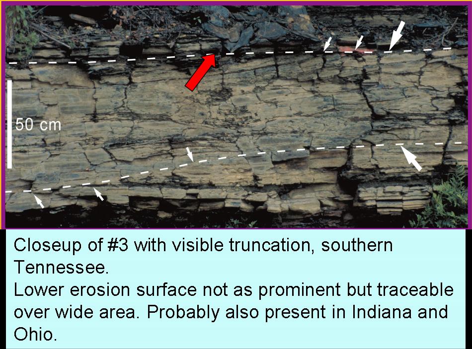 |
Two erosion surfaces in the Gassaway member of the Chattanooga Shale. Both surfaces can be traced over large distances.The upper surface marks the base of the Middle Gassaway member, a lateral equivalent of the Camp Run Member of the New Albany Shale in Kentucky and Indiana. |
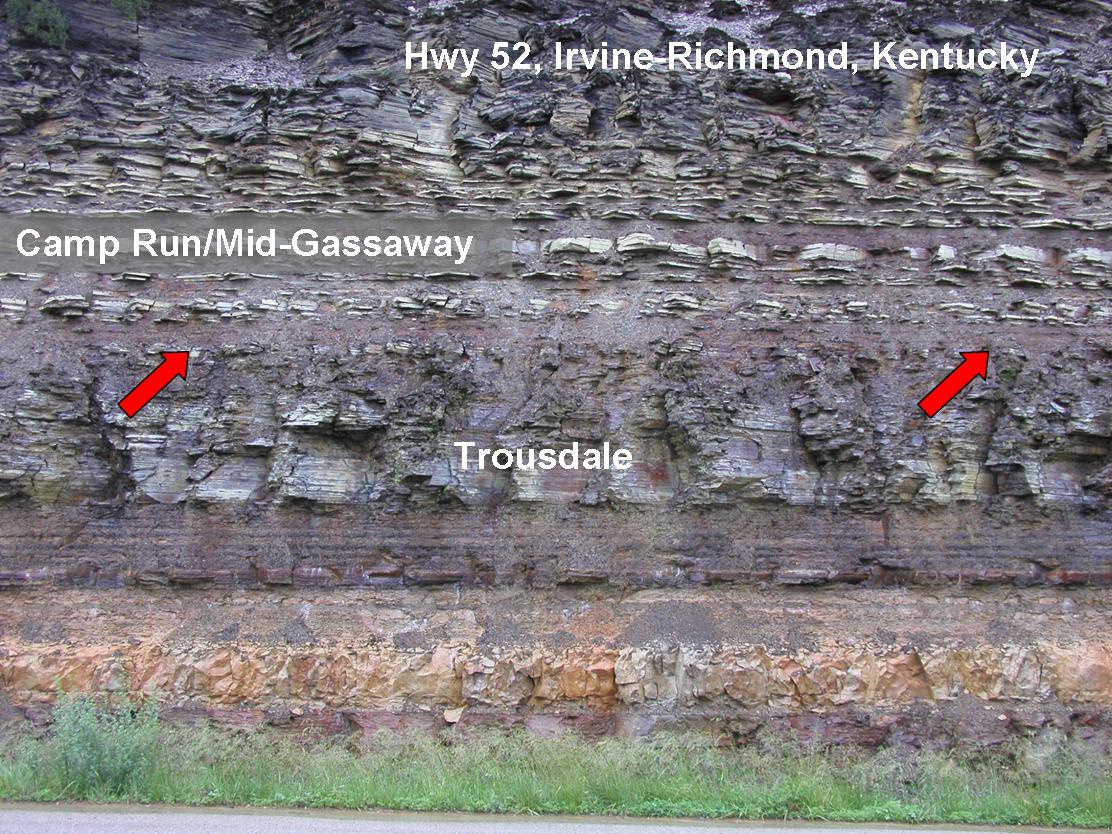 |
The red arrows mark the base of mid-Famennian shales (above) in east-central Kentucky. The package above the arrows is essentially the same as in the picture above. However, the shales below the arrows are Givetian to early Frasnian in age. Contrary to the Tennesse outcrops (above), most of the Frasnian and the lower to mid-Famennian are missing. |
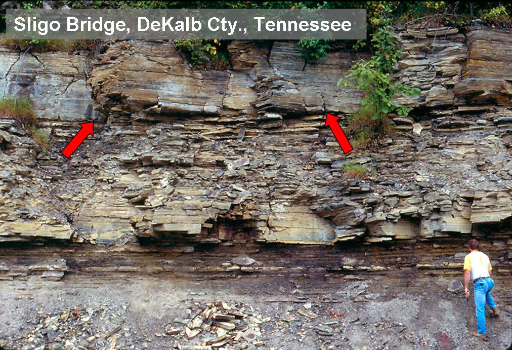 |
The red arrows mark the erosive base of the Upper Gassaway member of the Chattanooga Shale. The shale package below the arrows is the Middle Gassaway member. This surface also marks the base of the Clegg Creek member (New Albany Shale) in Indiana. |
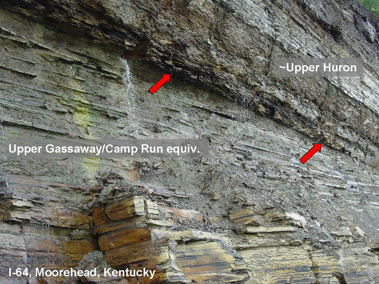 |
The red arrows in this image point to the same surface as those in the previous image. The contact is equivalent to the base of the Clegg Creek (Indiana) and Upper Gassaway (Tennessee). |
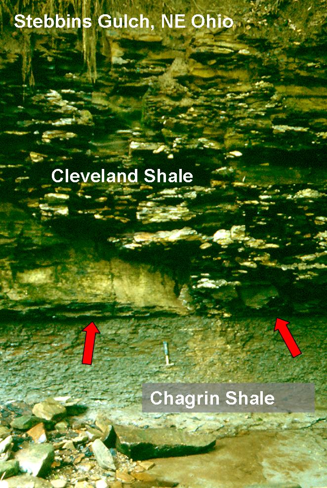 |
The red arrows mark the erosive contact between the Cleveland Shale (above) and the Chagrin Shale (below). There are scours and lenses of pebbles (sandstone/siltstone from underlying Chagrin) and sand at the contact. This surface traces all the way into Tennessee. |
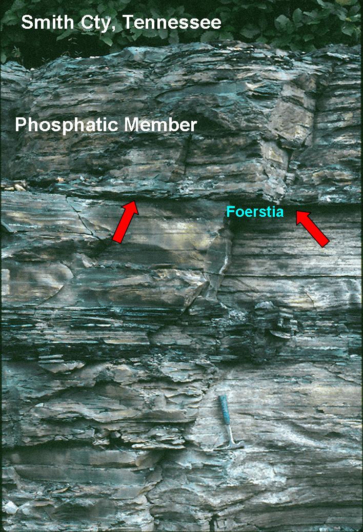 |
The red arrows point to an erosion surface that juxtapose a Cleveland Shale equivalent (phosphatic member) and shales of the Upper Gassaway member the Chattanooga Shale. The fact that we find the fossil alga Foerstia in the shales just beneath this surface indicates substantial erosion. In eastern Kentucky and Ohio the missing interval would amount to several hundred meters of shale. |
|
|
|
| Back to SHALE RESEARCH LAB Main Page | |
| Back to IU Department of Geological Sciences | |
|
© Jürgen Schieber, IU Bloomington Department of
Geosciences Last updated: February 08, 2022. |
|